

Weather - Athens Georgia
Click the images below for weather from different locations.
Athens Area Weather Stations
National Weather Service Links
With all of this dry weather another ham was complaining about paying his water bill. So I sent him a ‘get well soon’ card.
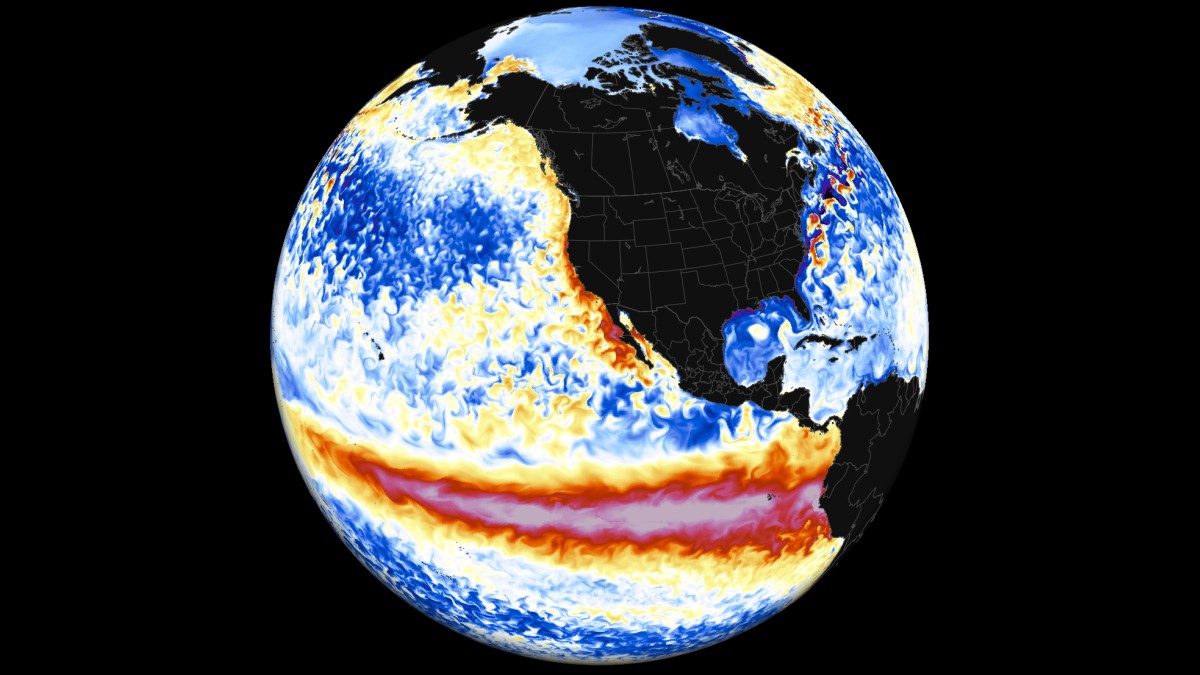
El Nino
The NWS Climate Prediction Center predicts a 61% chance of transitioning into an El Nino in May-July or 2026.
El Niño is characterized by unusually warm ocean temperatures in the Equatorial Pacific, as opposed to La Niña, which is characterized by unusually cold ocean temperatures in the Equatorial Pacific. El Niño and the Southern Oscillation, also known as ENSO, is a periodic fluctuation in sea surface temperature (El Niño) and the air pressure of the overlying atmosphere (Southern Oscillation) across the equatorial Pacific Ocean. ENSO has important consequences for weather in the U.S. and around the globe. El Niño conditions are typically experienced every two-to-five years.
El Niño was originally recognized by fishermen off the coast of South America as the appearance of unusually warm water in the Pacific Ocean, occurring near the beginning of the year. El Niño means The Little Boy or Christ child in Spanish. This name was used for the tendency of the phenomenon to arrive around the Christmas holiday.
To provide necessary data, NOAA operates a network of buoys which measure temperature, currents and winds in the equatorial band of the Pacific Ocean. These buoys transmit daily data which are available to researchers and forecasters around the world in real time.
What Upcoming El Niño Means for North and Central Georgia.
How warm/cool/wet/dry will it be this summer/fall/winter/spring?
Atmospheric Code Red: 2026 Super El Niño Now Trending Toward Record-Breaking Intensity
Seasonal Creep
Have you noticed over recent years, spring is arriving a lot earlier? It is true! Trees in Georgia are generally blooming earlier than they have historically. Data…indicate a clear trend of "seasonal creep"—where spring arrives earlier and fall arrives later.
The Risk: The danger in Georgia isn't just the early bloom; it's the Late Spring Freeze. Because the average temperature is higher, trees "wake up" during a warm week in February, but the atmospheric variability still brings a frost in late March, which can kill the peach crop or ruin the hydrangea blooms.
Read more from Glenn Burns on Facebook.
USA-NPN "Status of Spring" map.
NWS Storm Reporting
Skywarn
Other Weather Links
Traffic
Hurricanes
Power Outage Maps
Winter Weather
Treetops Emit Ultraviolet Sparkles During Thunderstorms.
Researchers Just Filmed It in Nature for the First Time. These outbursts—called coronae—are typically too faint for human eyes to detect. But since they also emit light at ultraviolet wavelengths, scientists were able to use a special setup involving a UV camera to document them outside of a laboratory.
— Smithsonian magazine
Mackerel Sky
This is a beautiful shot of a Mackerel Sky! The specific clouds you're looking at are Altostratus.
These are "middle-altitude" clouds, typically found between 6,500–20,000 feet. They look like small, white or gray patches or "clumps." Unlike higher Cirrocumulus clouds (which look like tiny grains of rice), these have distinct shading and look larger, about the width of three fingers when you hold your hand at arm's length toward the sky.
They form when a large sheet of air is lifted and then cooled, breaking into these individual cells or rolls due due to different wind speeds at different altitudes.
In folklore, this is often called a Mackerel Sky because the pattern resembles the scales on a fish. Usually a sign of rain in 24-48 hours.
From Glenn Burns on Facebook.
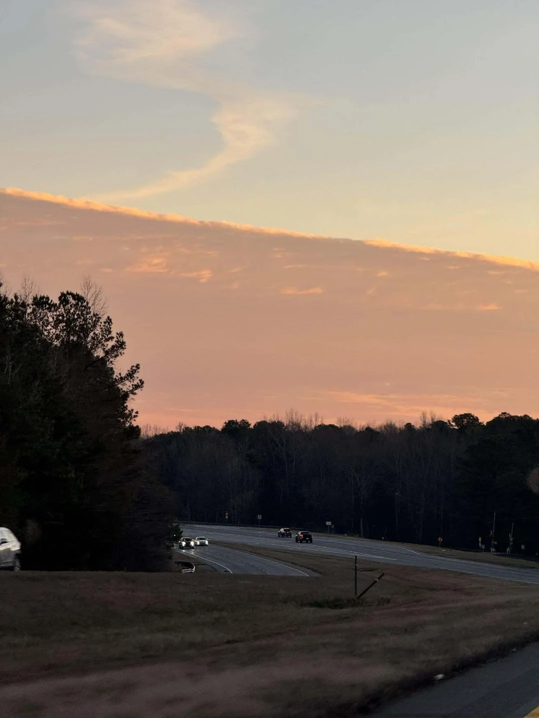
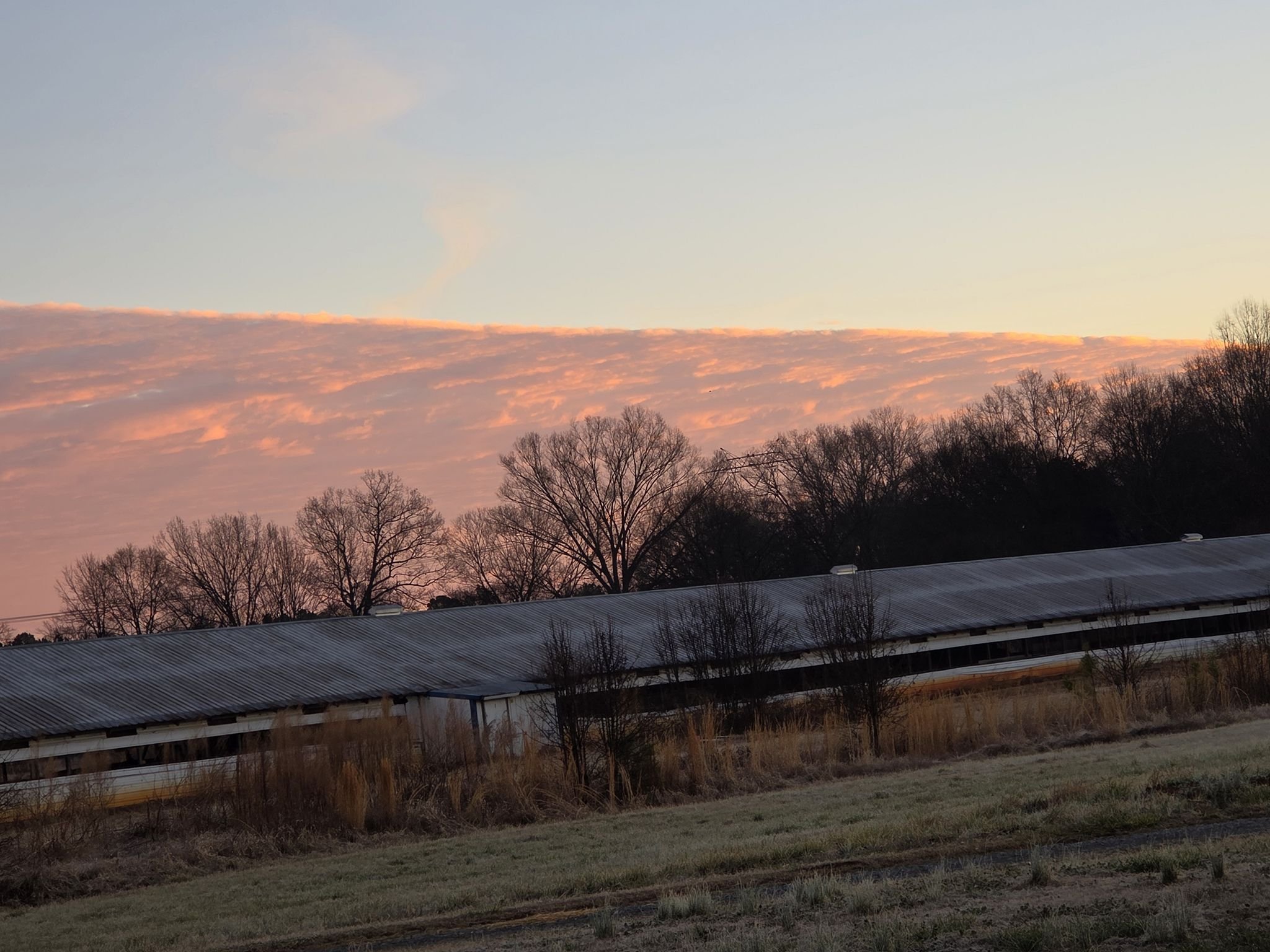
Stratus Fractus
That striking, straight-edged formation is known as a stratus cloud (specifically a stratus fractus or a low-level altostratus bank), but the phenomenon of that perfect, sharp line is often referred to as a "Cloud Front" or a "Sharp Edge" cloud.
That perfectly straight line isn't a single cloud, but rather the boundary between two different air masses.
You are looking at a front where dry, stable air is pushing against moist air. The moisture is forced to condense exactly at that boundary, creating a "wall" of cloud.
Because you are viewing it from a distance, the flat base of the cloud layer appears as a sharp diagonal line due to the Earth's curvature and your angle of perspective. Very cool !
From Glenn Burns on Facebook.
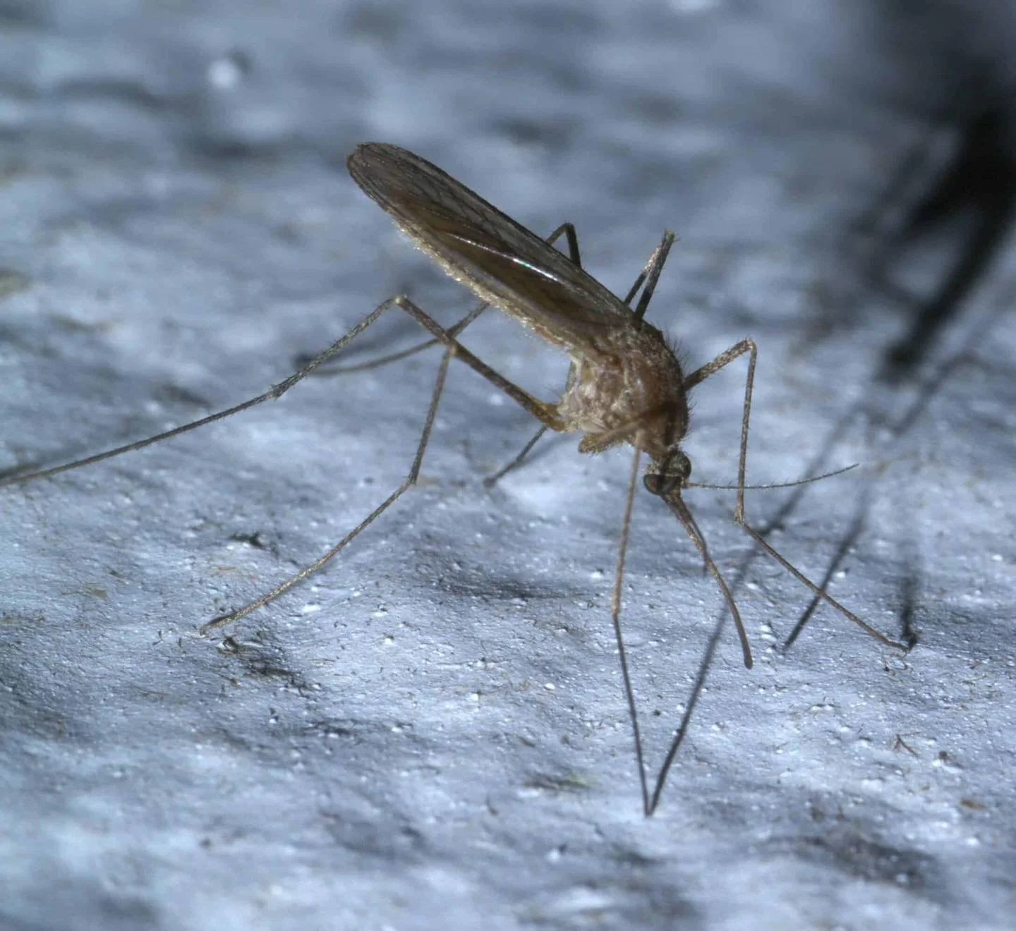
The End of Mosquitoes
While a cold snap might feel like it should be the "end" for mosquitoes, the reality in the Southeast is a bit more complicated. Most mosquitoes don't actually die off; they just hit the "pause" button.
Here is how they survive the Southern winter:
The 50-Degree Rule
Mosquitoes are cold-blooded and cannot regulate their body temperature.
Below 50°F: They become lethargic and generally stop flying or biting.
At Freezing (32°F): Most adult mosquitoes will die if they are exposed, but they are experts at finding "micro-climates"—protected spots like crawlspaces, hollow logs, or thick leaf litter—to stay just warm enough to survive.
Hibernation (Diapause)
Many species in states like Georgia, Alabama, and the Carolinas enter a state called diapause. They essentially "hibernate" by slowing their metabolism to a crawl. They can stay in this state for months, waiting for a string of days above 50°F to wake up and start biting again.
"Winter-Hardy" Eggs
Even if a severe freeze kills every adult mosquito in your yard, the population is usually safe. Many species lay eggs in the fall that are designed to survive sub-freezing temperatures. These eggs can sit in dry or frozen dirt all winter and will only hatch once the spring rains arrive and the water temperature rises.
So the bottom line is, the skeeters will be back, regardless of the cold.
From Glenn Burns on Facebook.