
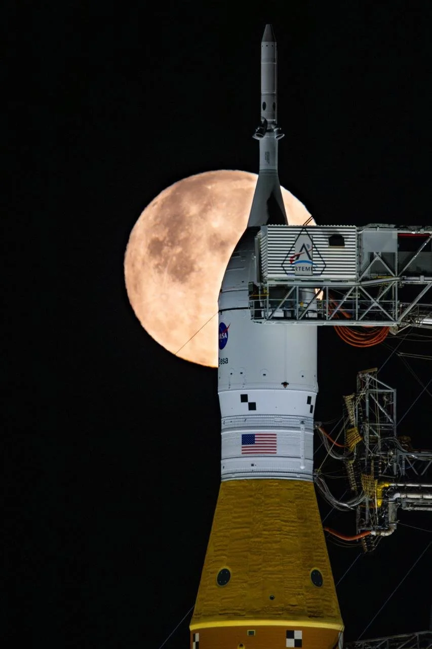

Artemis II Mission
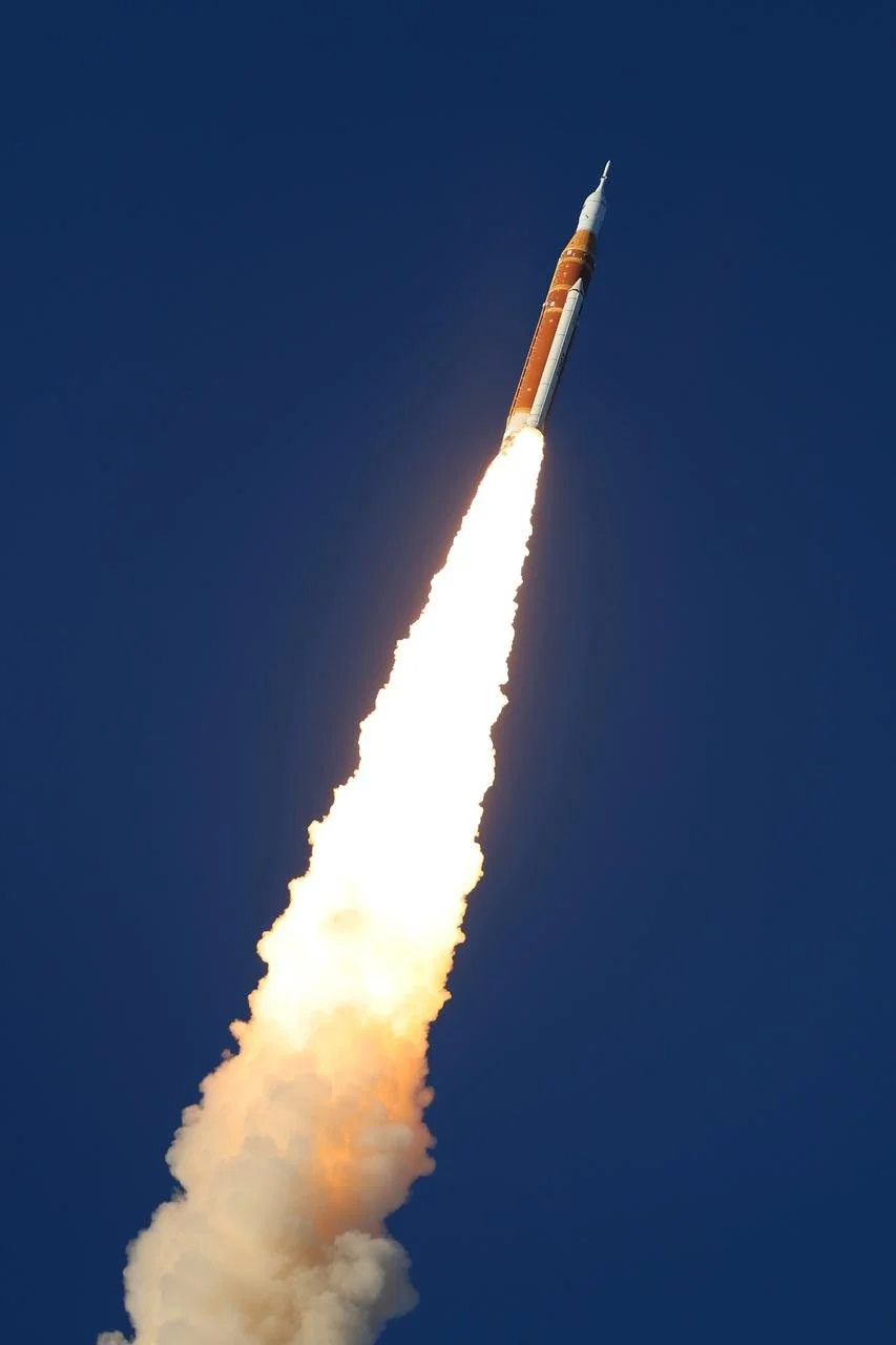
NASA’s SLS (Space Launch System) rocket lifted off from Launch Pad 39B at the agency’s Kennedy Space Center in Florida at 6:35 p.m. EDT Wednesday, sending four astronauts aboard the Orion spacecraft on a planned test flight around the Moon and back.
The successful launch is the beginning of an approximately 10-day mission for NASA astronauts Reid Wiseman, Victor Glover, Christina Koch, and CSA (Canadian Space Agency) astronaut Jeremy Hansen. As the first crewed mission of NASA’s Artemisprogram, among its objectives, the flight will demonstrate life support systems for the first time with crew and lay the foundation for an enduring presence on the Moon ahead of future missions to Mars.
After reaching space, Orion deployed its solar array wings, enabling the spacecraft to receive energy from the Sun, while the crew and engineers on the ground immediately began transitioning the spacecraft from launch to flight operations to start checking out key systems.
If all systems remain healthy, mission controllers will give Orion’s European-built service module a command to conduct the translunar injection burn on Thursday, April 2. This move is an approximately six-minute firing to send the spacecraft on a trajectory that will simultaneously carry crew around the Moon, while also harnessing lunar gravity to slingshot them back to Earth.
During a planned multi-hour lunar flyby on Monday, April 6, the astronauts will take photographs and provide observations of the Moon’s surface as the first people to lay eyes on some areas of the far side. Although the lunar far side will only be partially illuminated during the flyby, the conditions should create shadows that stretch across the surface, enhancing relief and revealing depth, ridges, slopes and crater rims that are often difficult to detect under full illumination. Crew observations and other human health scientific investigations during the mission, such as AVATAR, will inform science during future Moon missions.
Following a successful lunar flyby, the astronauts will return to Earth and splash down in the Pacific Ocean on April 10th.
How to Watch:
Yet another Artemis tracker
NASA's Artemis II Live Mission Coverage (Official Broadcast) This feed will provide continuous coverage of Artemis II mission activities with live commentary
NASA's Artemis II Live Views from Orion As bandwidth allows, this stream will feature live views from Artemis II's Orion spacecraft, without commentary
Artemis Live tracking map from ISSInfo.net
Multi-Camera views during flight
Lunar Fly-by Images
Updates are available on the Artemis blog.
Search Artemis II Press Album
.jpg)
Out of all of the government agencies, the NSA is my favorite. It’s the only one that really listens.
VP Visit to Athens
There was a TFR (Temporary Flight Restriction) in place from April 14, 2026 at 1645 EDT to April 14, 2026 at 1959 EDT, tomorrow, for the Athens Airport. Apparently, JD Vance will be flying in to attend a Turning Point USA event at the University of Georgia / Akins Ford Arena. Erika Kirk is also scheduled to appear at that event.
Prep your scanner with the following frequencies:
132.475 AM — Atlanta Approach
291.100 AM — Approach UHF
126.300 AM — Athens Tower
338.275 AM — Tower UHF
121.800 AM — Athens Ground / Clearance
132.875 AM — ASOS (automated, real-time weather and airport data)
Look for Vance’s aircraft on ADSB Exchange, since it will usually show military planes. By clicking the “U” in the top right of the map screen you can limit the view to just military aircraft. It has been reported that he will come in a C-40 (the military version of the Boing 737). On the radio, listen for “Air Force 2”. On the ADSB map, it is likely that the callsign is not reported as AF-2 but will likely be the only military jet coming to Athens.
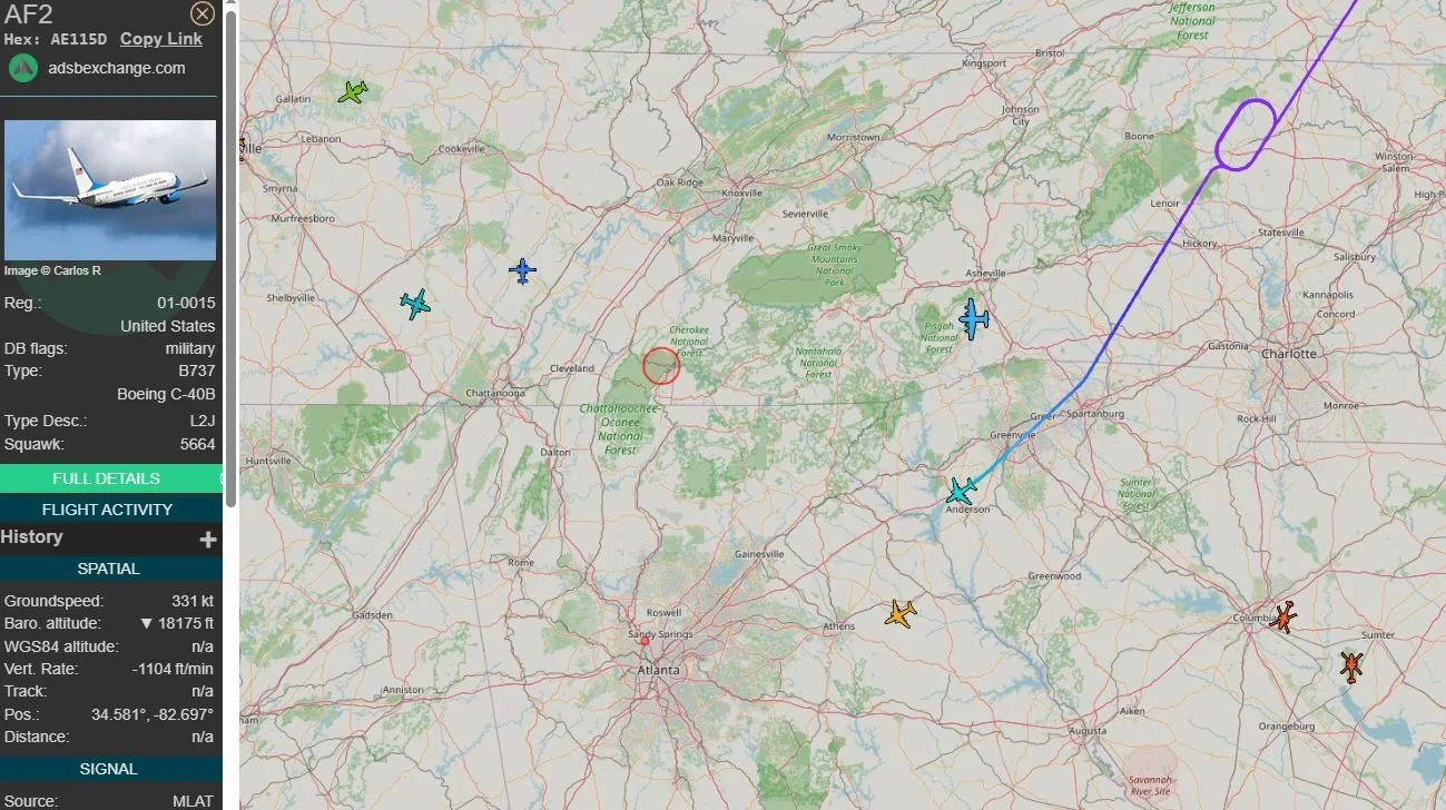
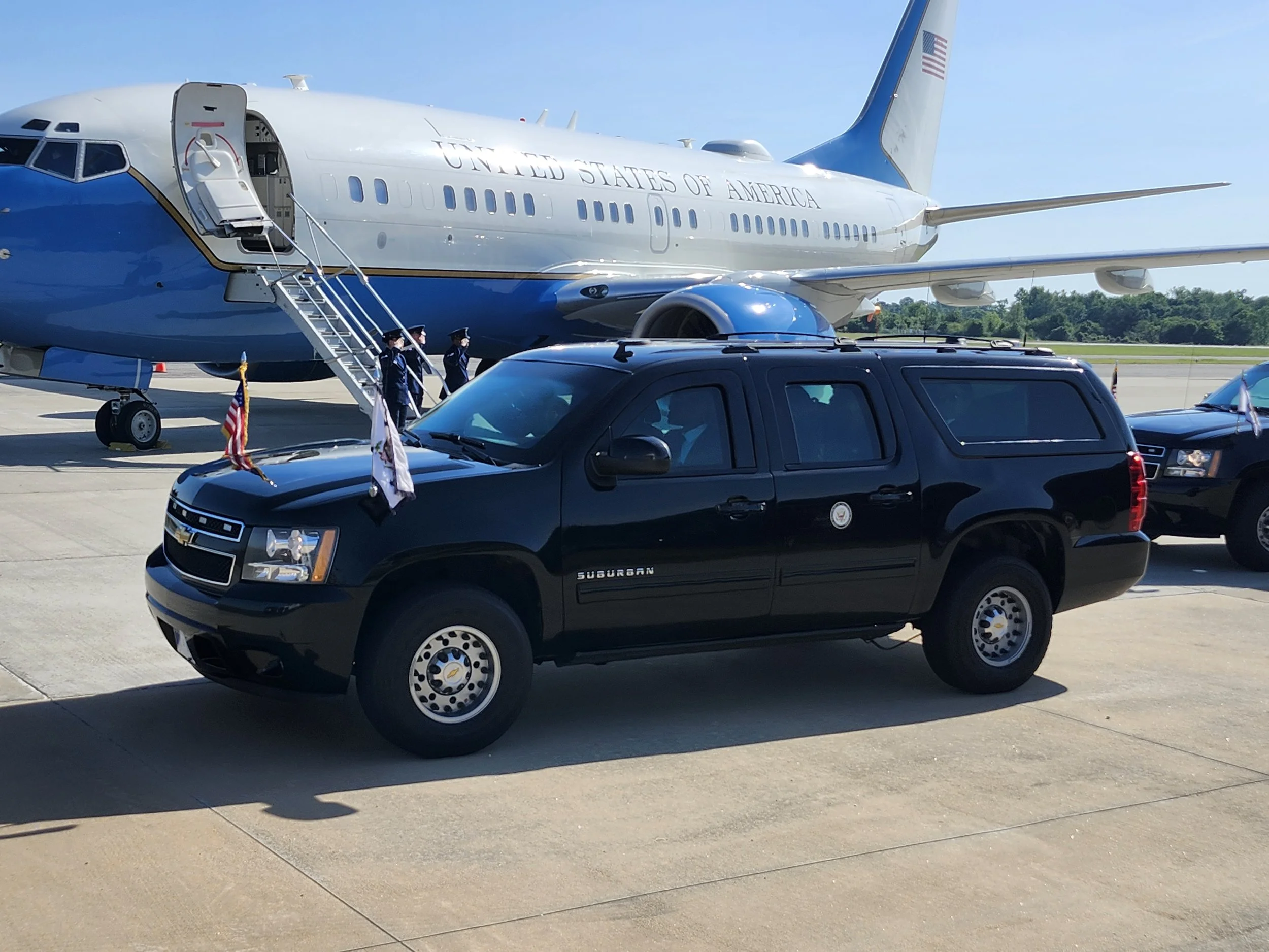
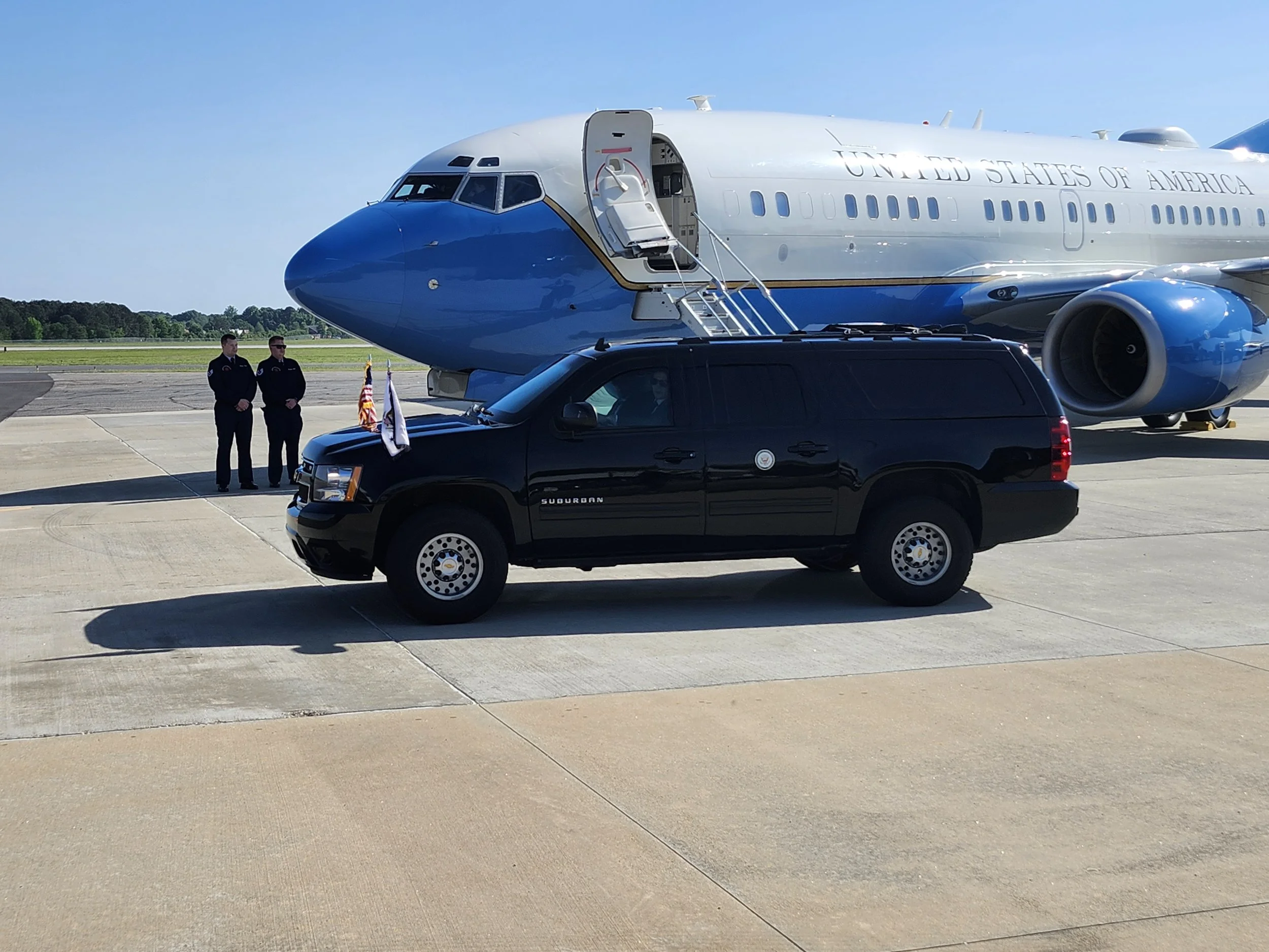
Air Force Two (AF2) and SAM2A on their way to Athens. From ADSB Exhange.
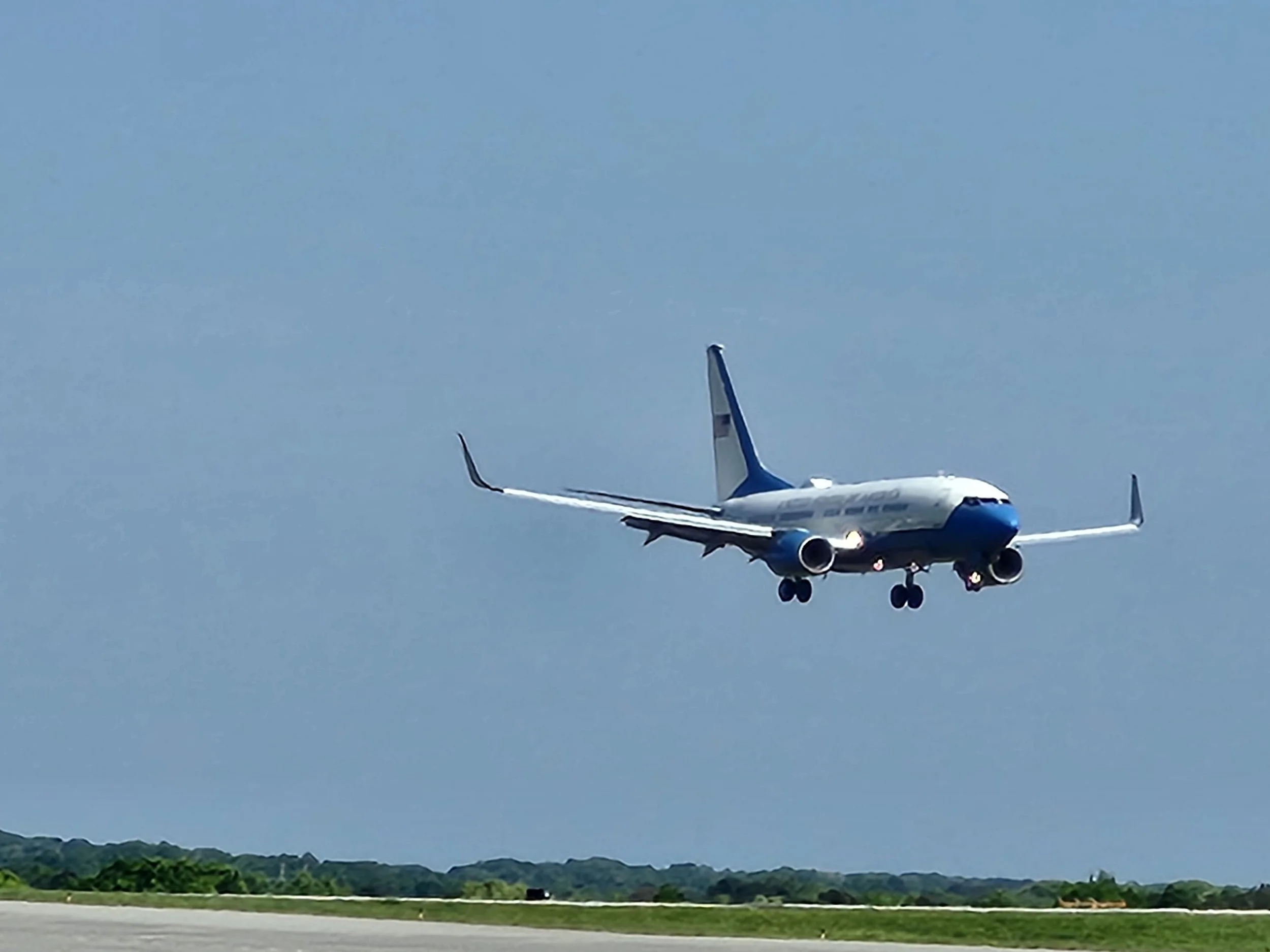
Air Force 2 on final for runway 27 in Athens, GA
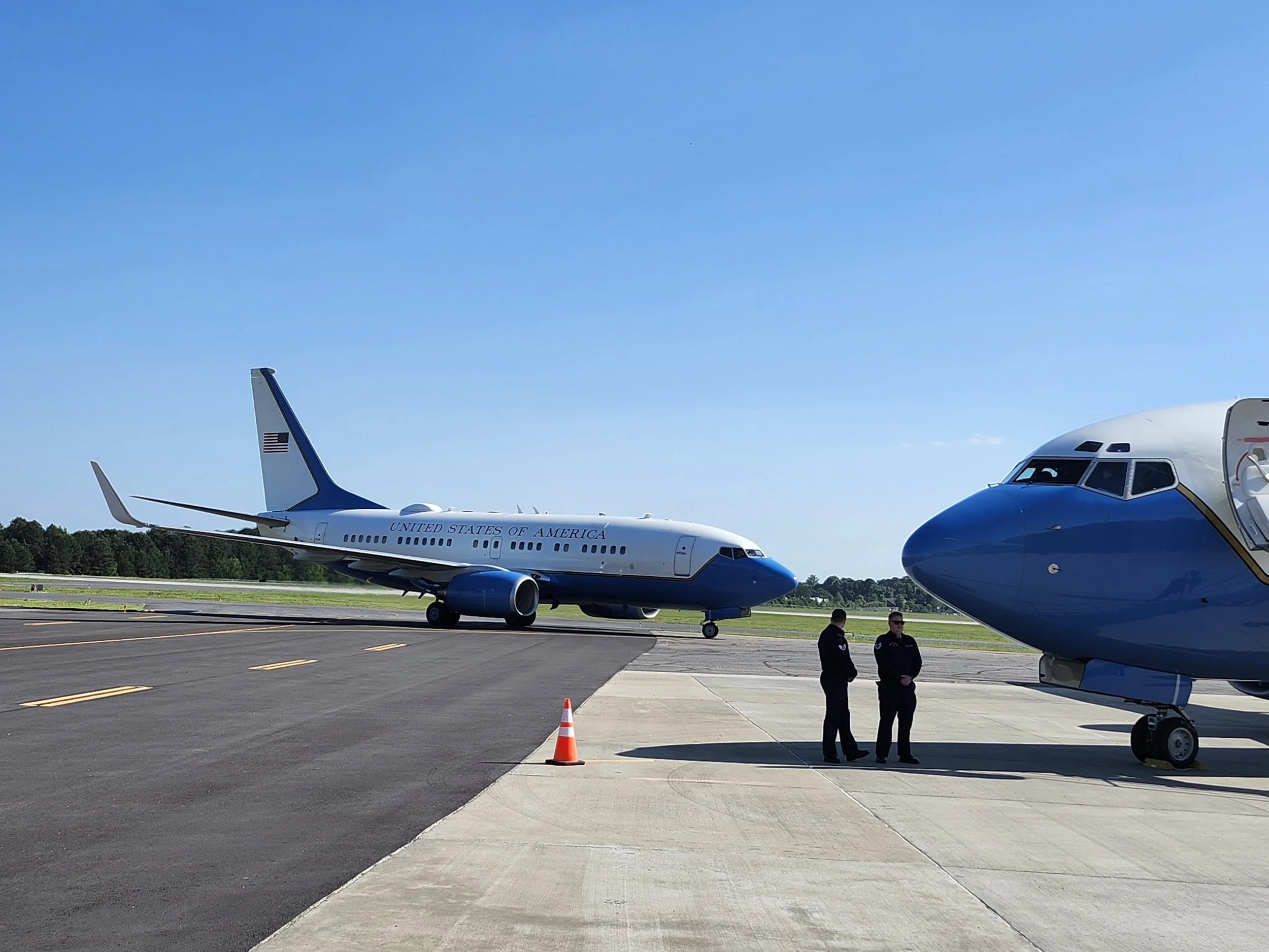
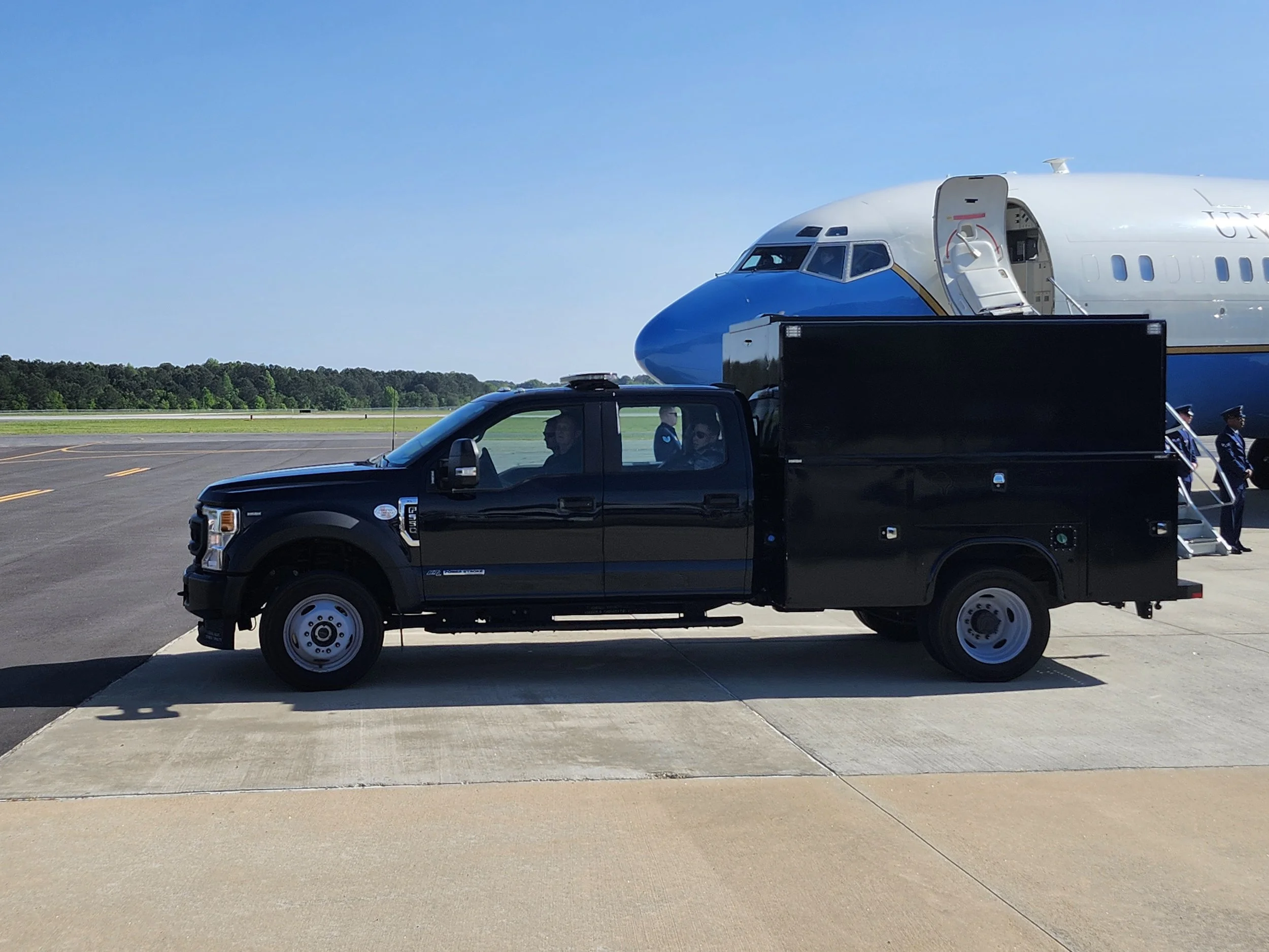
Air Force 2 taxis to the ramp.
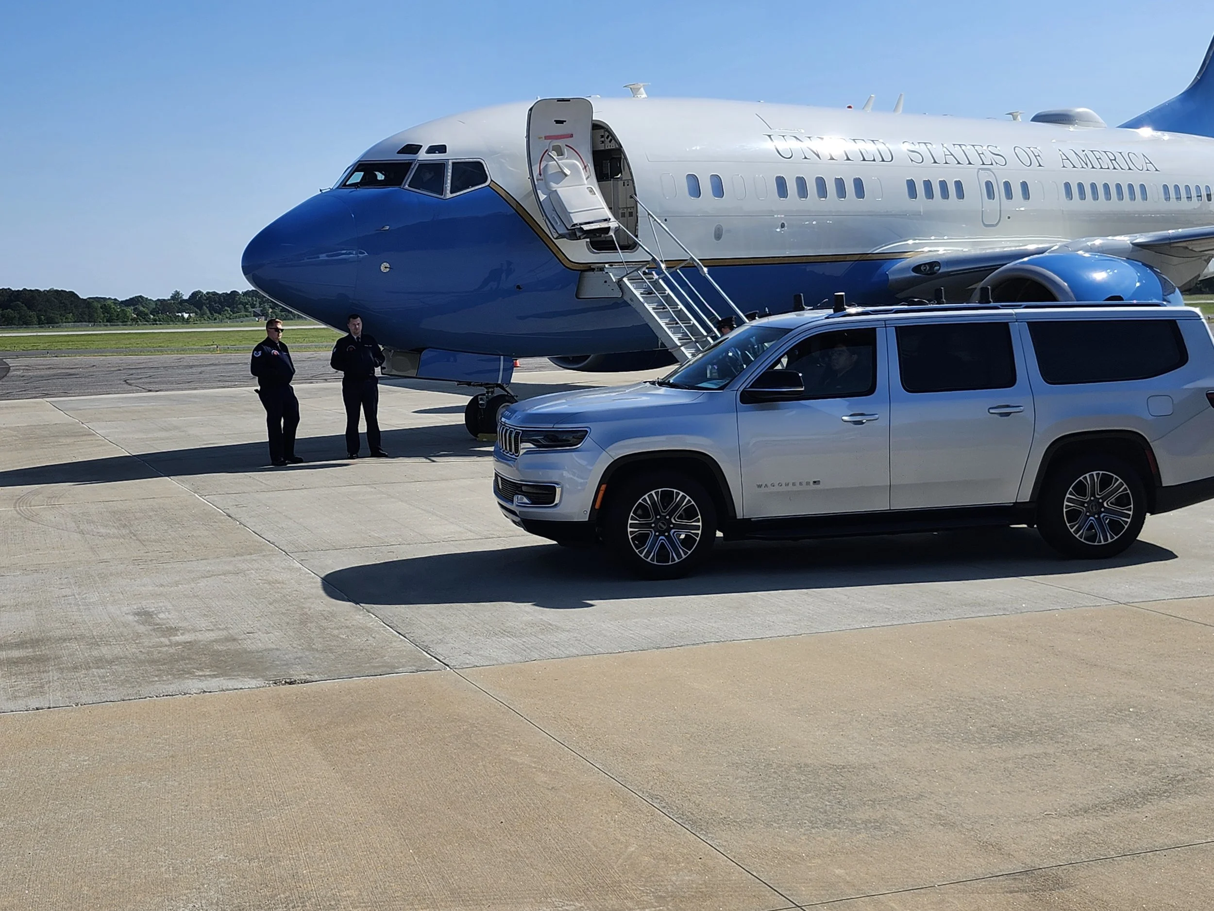
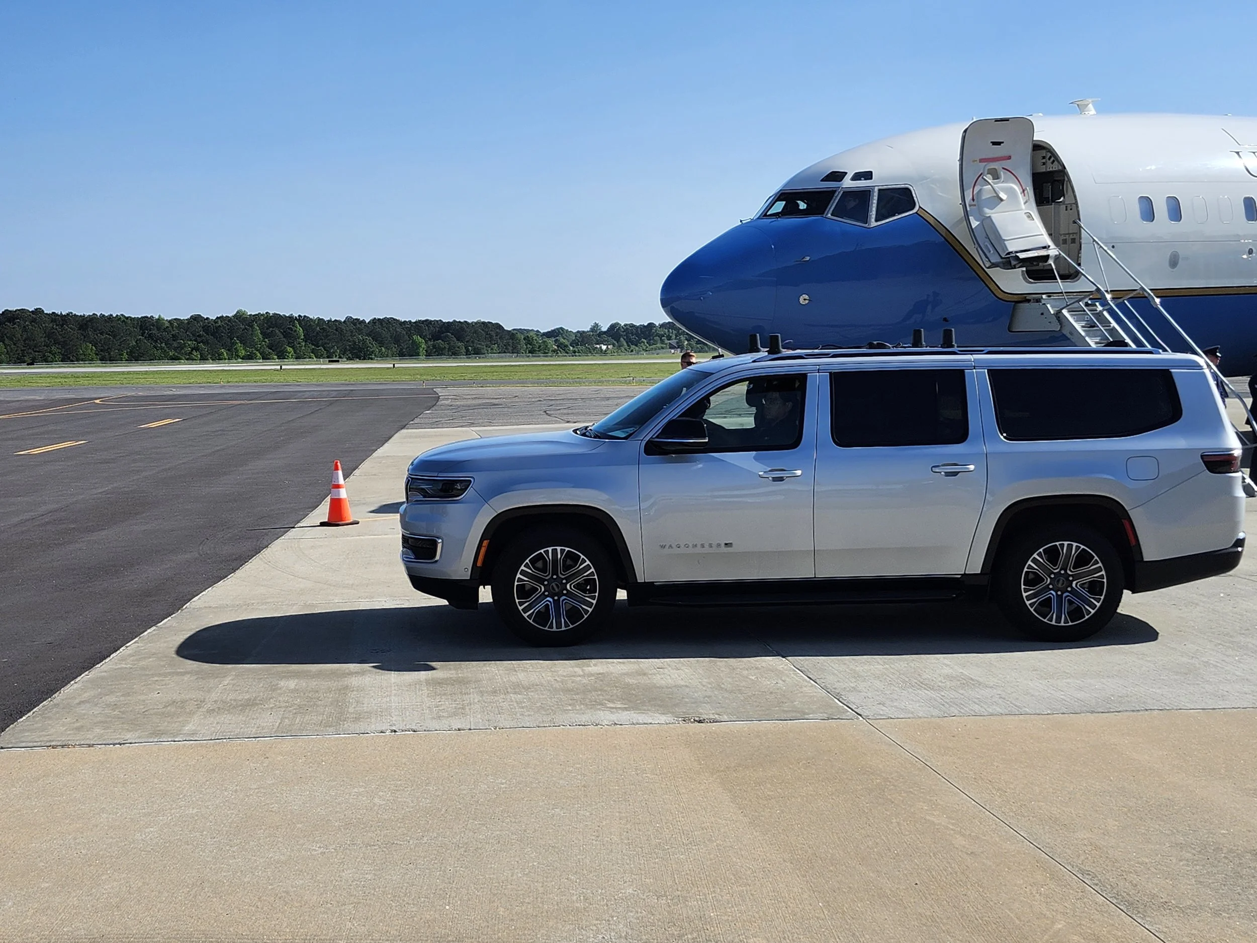
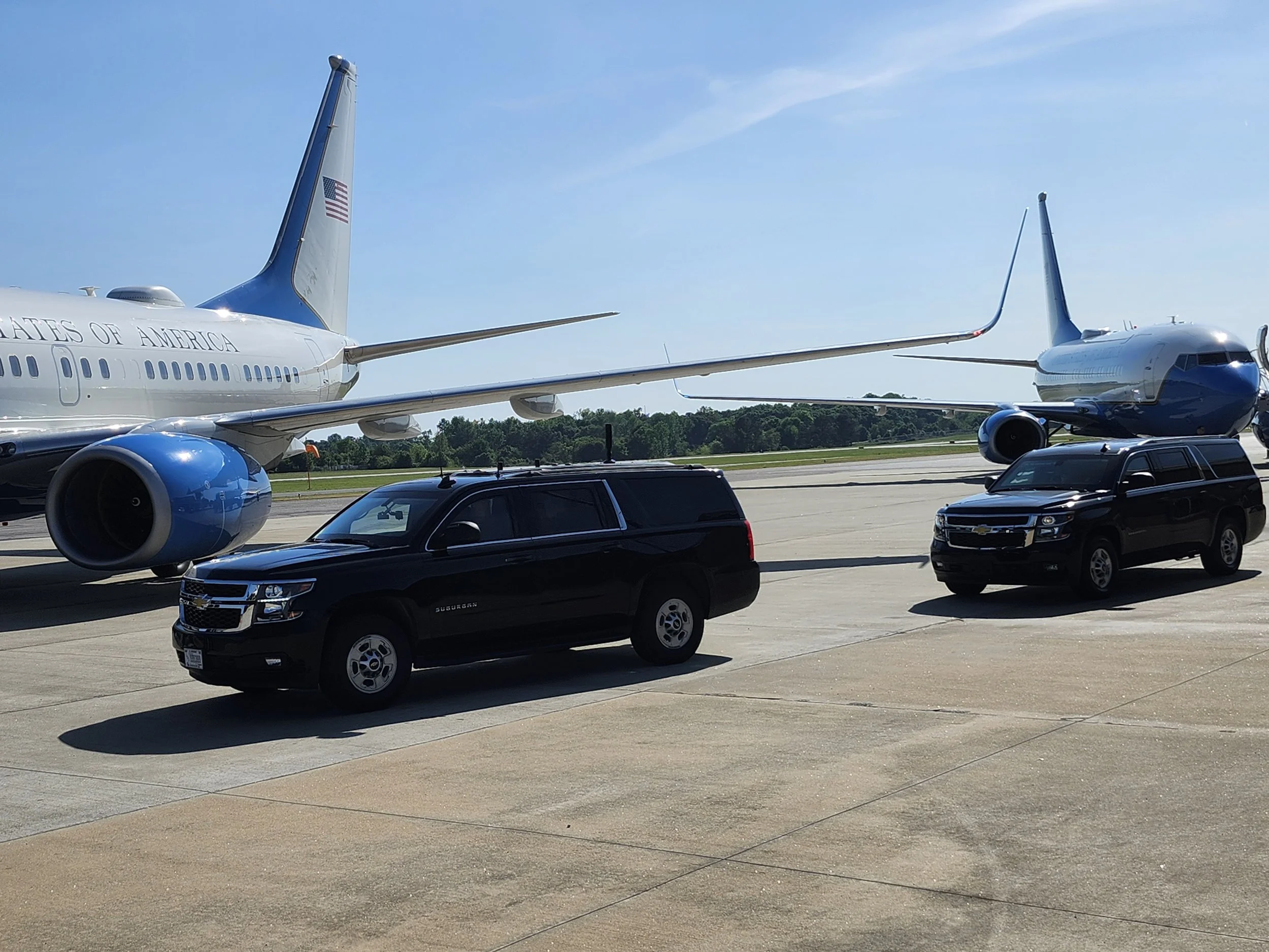
I was in the neighborhood, so I thought I would see if I could catch a glimps of Air Force Two arriving at the Athens Airport. It turns out that security was pretty lax and I managed to park in the Hertz parking lot, next to where the club meets.
I managed to hear SAM2A and AF2 talk on the Approach frequency, 132.475, and on the Tower frequency, 126.300. They used the civilian aircraft band and where not on UHF. The first 737, callsign SAM2A, was already pulled up in front of the building, unloading when I arrived. I was there about 10 minutes when Air Force Two was cleared to land. AF2 taxied right next to SAM2A.
I also monitored the ACCPD motorcade on 8TAC93, 852.5125 MHz. I got one hit from the Secret Service on my scanner. It was around 165.45 MHz but was encrypted. I didn’t write down the frequency so that is not the exact frequency but it was in that band. I didn’t do much scanning due to the noise and all of the activity. I did try to go into the terminal building, to take a picture of the aircraft through the windows, but the Secret Service would not let me in because “they had the building secured.”
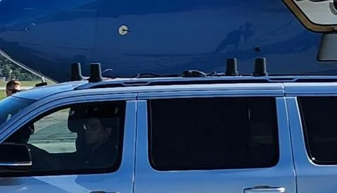
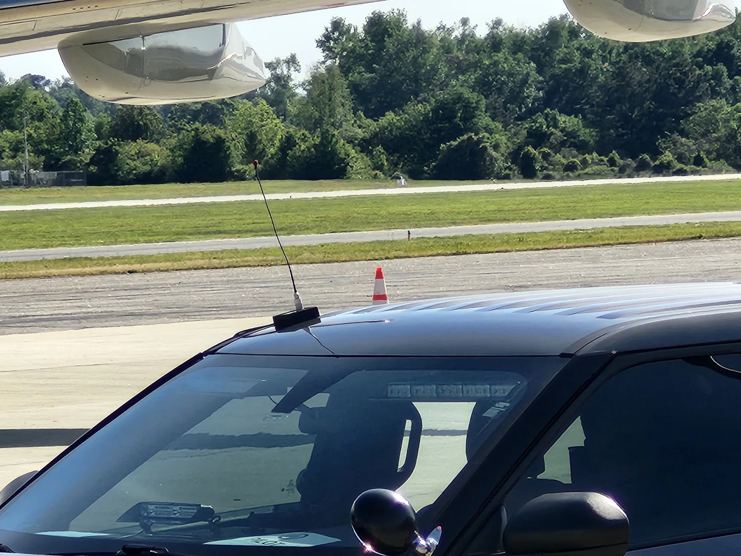
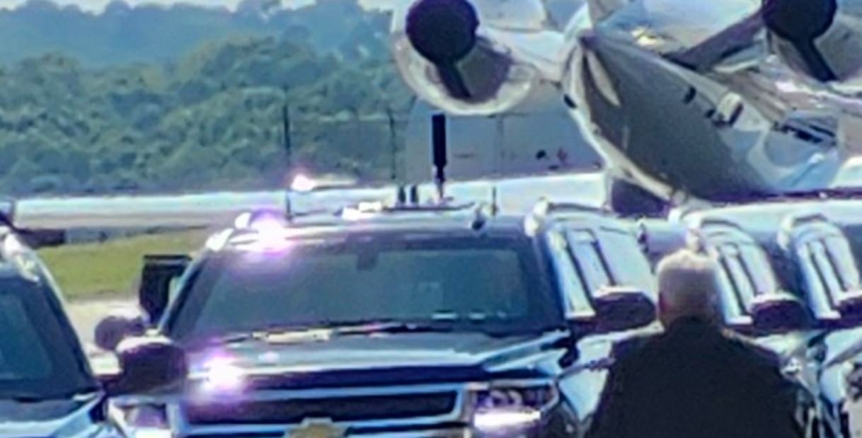
If you are like me, you are interested in the radio aspect of a visit so I tried to take some pictures of the antennas on the vehicles. Unfourtunatly, the camera on my phone is pretty poor so the pictures are lacking in detail.
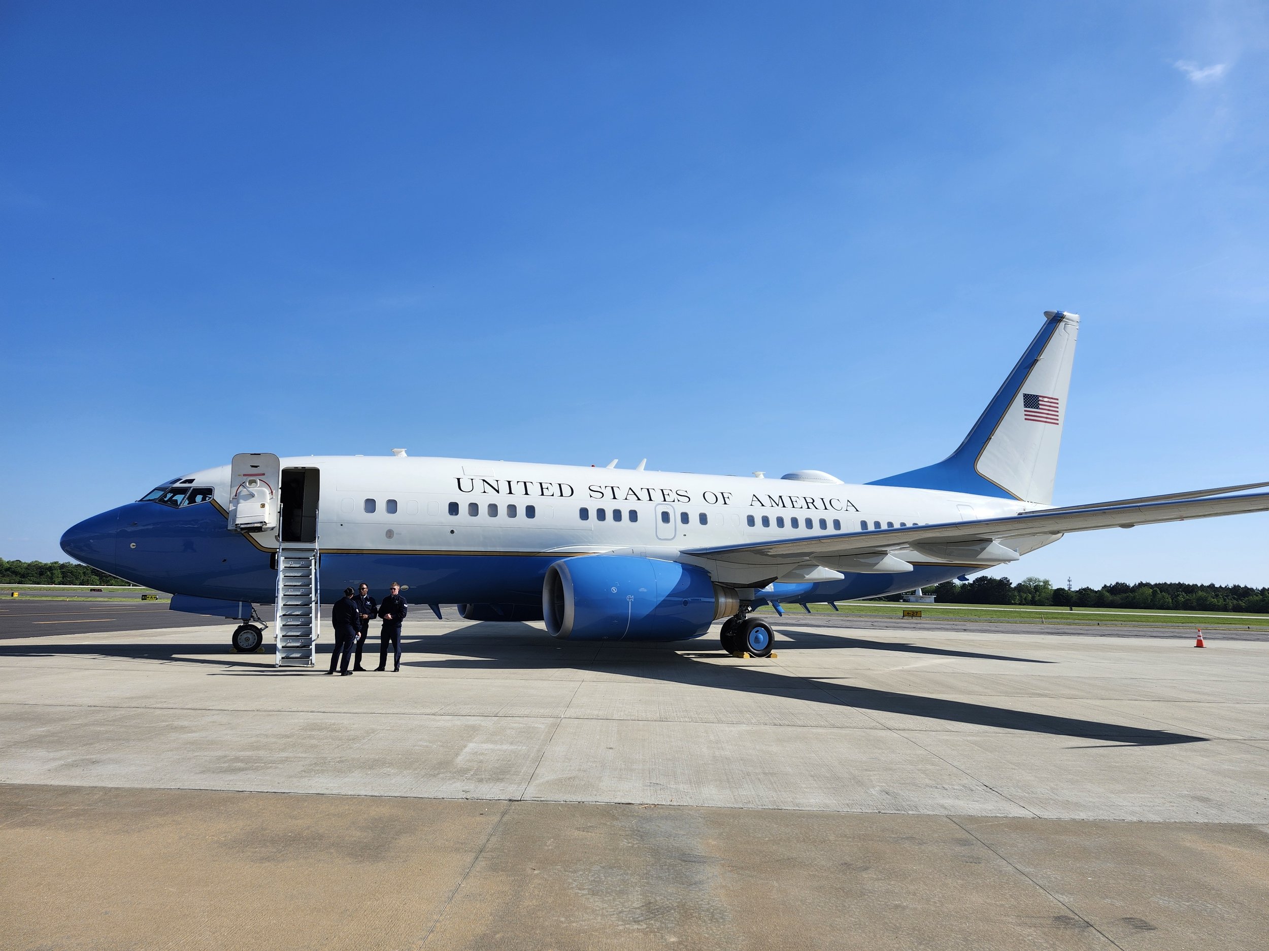
SAM2A sittng on the ramp.
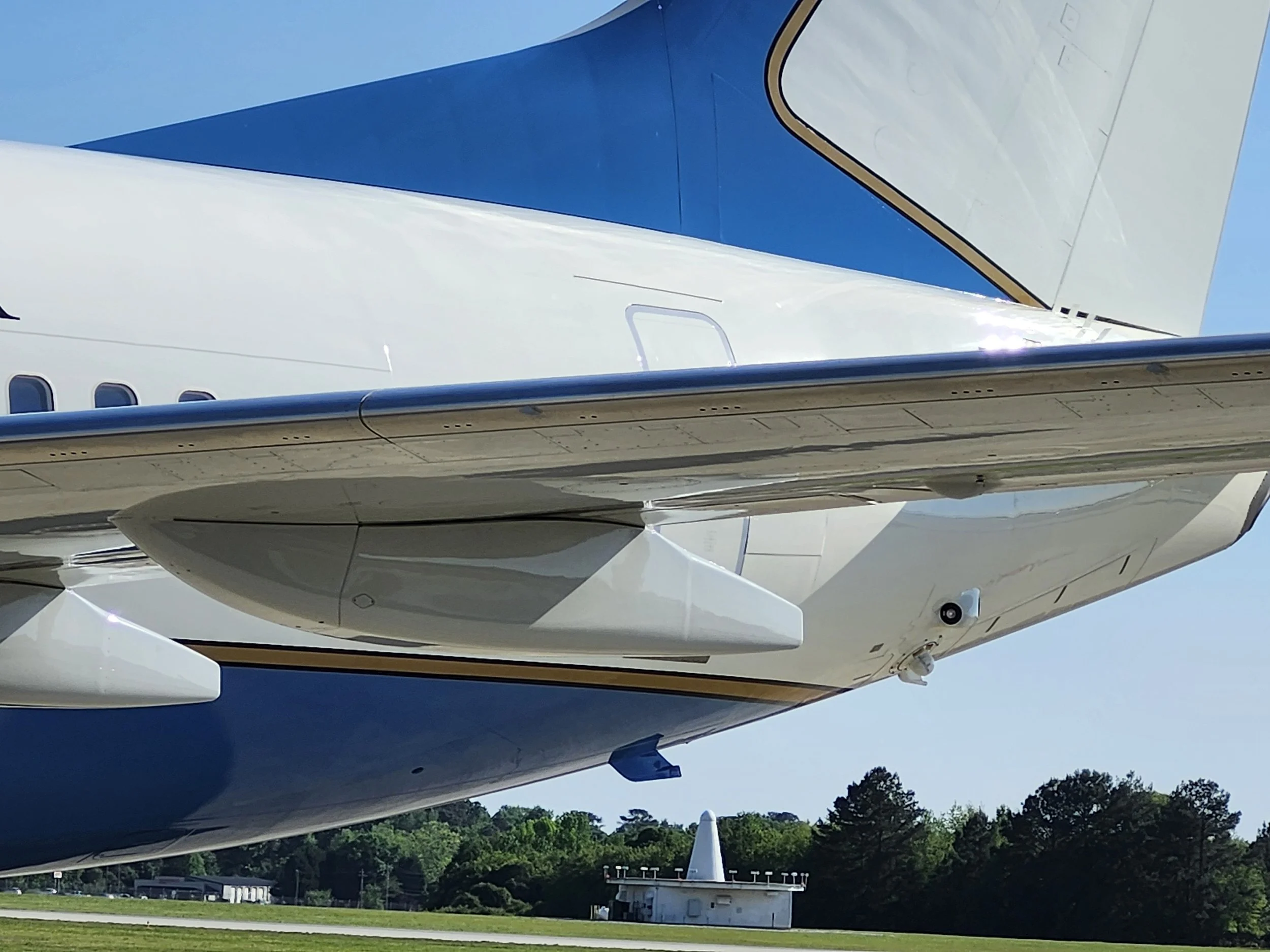
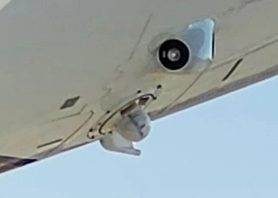
This is very likely a LAIRCM / DIRCM laser turret—the gimbaled jammer assembly. On these systems, the turret tracks an incoming heat-seeking missile and points a laser at the missile’s seeker to confuse or jam it. Official descriptions of the AN/AAQ-24 LAIRCM system say it uses a Guardian Laser Transmitter Assembly to track the inbound missile and aim the laser jammer automatically.
This vehicle might be the new White House Communications Agency Mobile Command and Control Vehicle (MC2V) vehicle nicknamed Roadrunner. Its primary job is to maintain high-bandwidth satellite and radio links for the entire convoy, which it can do from the rear while remaining protected by the motorcade's outer security layers. It is interesting to note that it look like the antennas are mag mounts.
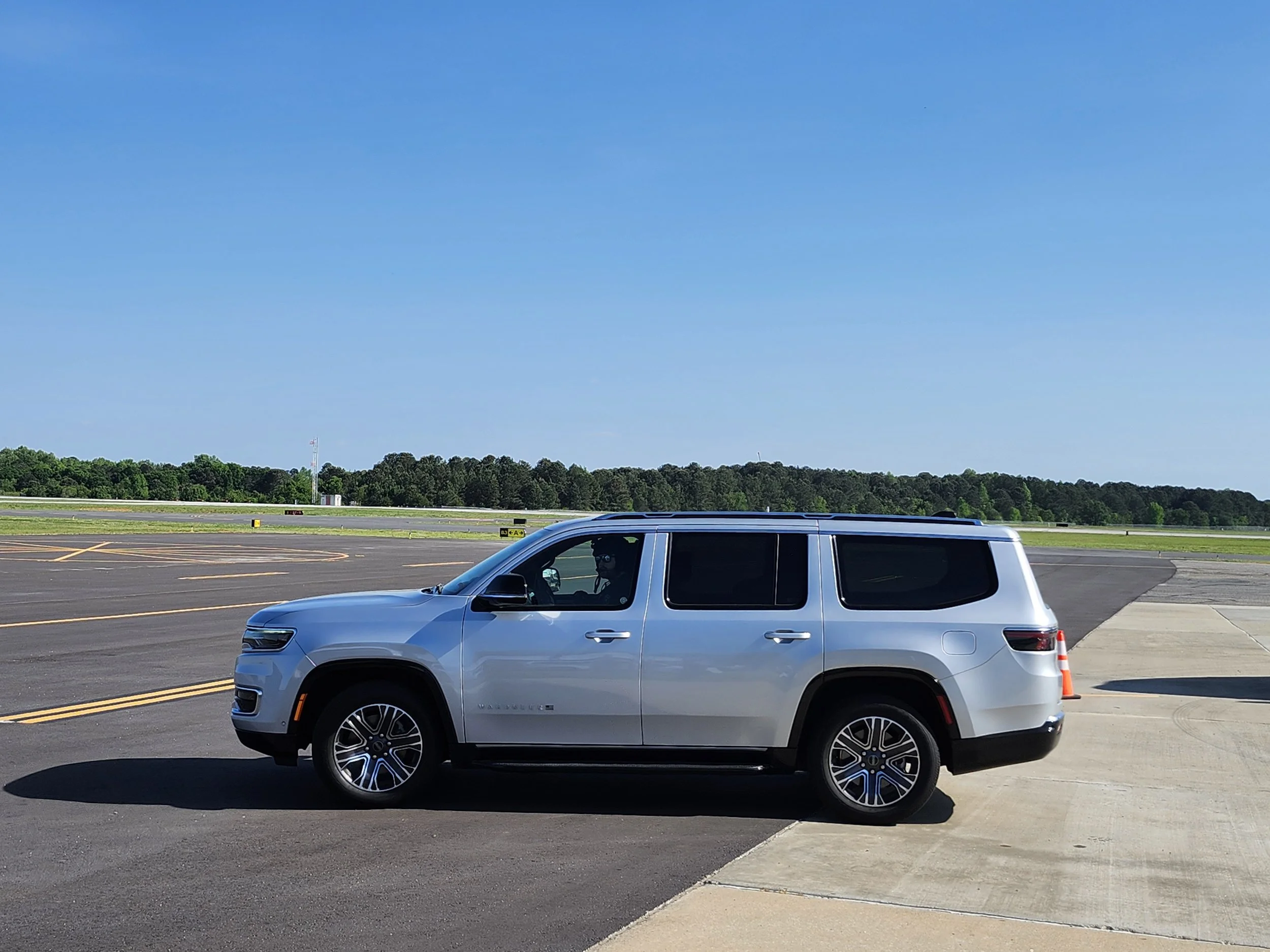
Most of the Secret Service vehicles in this motorcade are the new Jeep Wagoneer L (specifically the 2025 Command Operations Vehicle or COV variant) equipped for government and high-security motorcade duties.
Most of the local vehicles in the motorcade, such as the ACCPD cars and the GSP cars, were sporting a mag mount antenna supplied by the Secret Service.
This vehicle is probably Watchtower (Electronic Countermeasures Vehicle). To effectively protect from remote-controlled explosives and drones, this vehicle must stay in close proximity to the principal. It provides:
Signal Jamming (Counter-IED): Its most critical task is to jam radio frequencies within a specific radius, creating a "dead zone" for cell phones and other wireless devices. This prevents the remote detonation of Improvised Explosive Devices (IEDs) by blocking the signals that would trigger them.
Missile Warning: It provides the entire convoy with laser and radar warnings, identifying when a threat (like an anti-tank guided missile) is using a laser for designation or ranging.
Signals Intelligence: The vehicle constantly analyzes the local electronic environment to distinguish between harmless consumer electronics and potential weaponized transmissions.
The HAMMER (Hazardous Agent Mitigation Medical Emergency Response) unit. The unit is part of the Secret Service Special Operations Division and is designed to provide immediate rescue, decontamination, and specialized medical care in the event of a chemical, biological, radiological, or nuclear (CBRN) attack on the motorcade.
This looks like the CAT (Counter Assault Team) vehicle. They are responsible for counter-attacking and neutralizing any incoming threats. Notice the driver is already outfitted in full battle gear.
There are two “identical” armored vehicles for the protectee. One has the protectee and the other is a decoy. In these two pictures, you can see a satellite antenna mounted on the roof racks of one while the other appears to have a surface mount satellite antenna above the driver’s area.
Read more about the Presidential Motorcade.
Read more about the Roadrunner vehicle and the newer stretched version.
Read about the conversion of old Roadrunner vehicles into Crisis Response Team vehicles for Special Operations Command North.
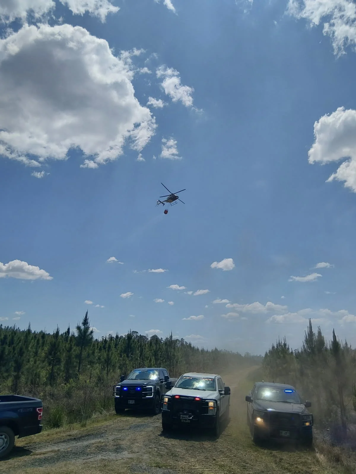
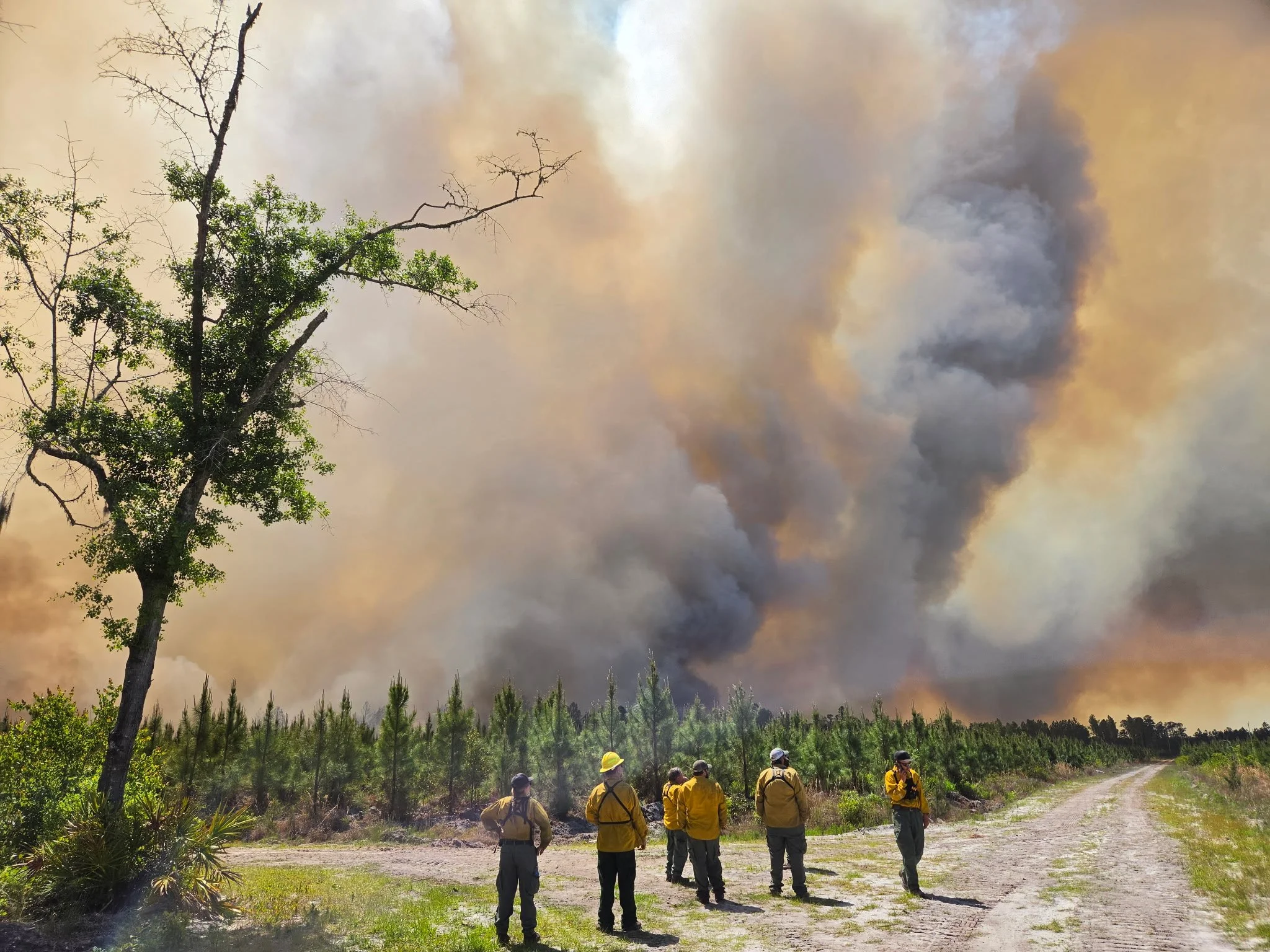
Air attack on the Highway 82 Fire.
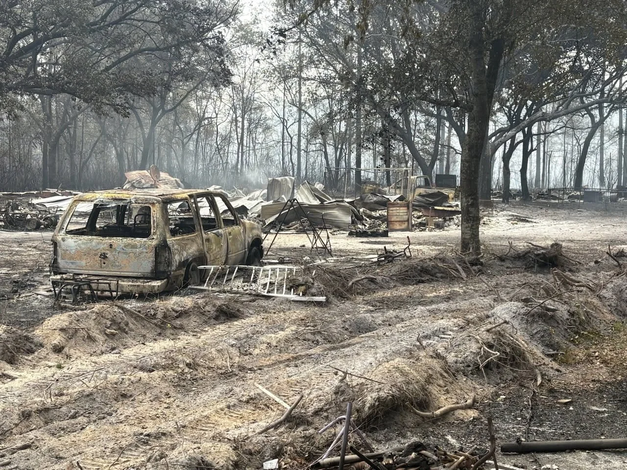
Area burned by the Highway 82 Fire.
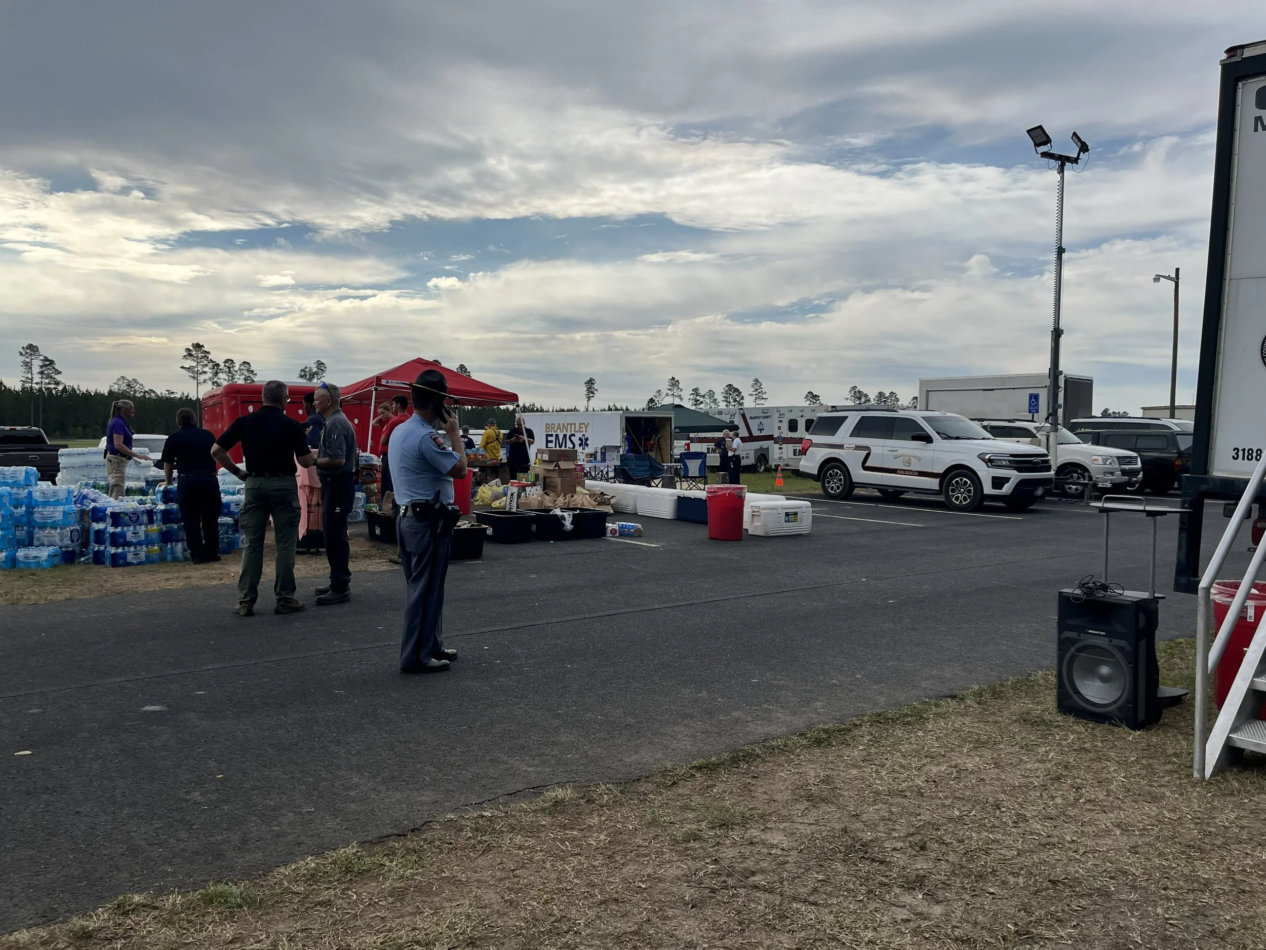
Resources staged for the Highway 82 Fire.
Georgia WildFires
There are currently a couple of high profile fires occurring in Georgia. Governor Brian Kemp has declared a State of Emergency in response to these fires and the lower half of Georgia is under a burn ban.. Here are some resources to help you keep up with forest fires in Georgia.
Current Wildfire Infomation from the Georgia Forestry Commission. There is an expandable section for each current fire. You must toggle the section open to see the details of the fire.
Fuels and Fire Behavior Advisory for April from the Southern Area Coordination Center of the National Interagency Fire Center.
US Drought Monitor – Georgia
Maps:
Georgia Forestry Commission Fire Incidents and Air Quality Index (AQI) Map. Red Diamonds on the map are active fires.
National Forest Service Fire and Incidents Map.
Regional Fire Map from Western Fire Chiefs Association.
Smoke Map from Accuweather.com
South Georgia Fires:
Video of resources attacking the Highway 82 Fire in Brantley County.
More images and videos of the Highway 82 Fire.
Video of Pineland Rd Fire at night.
More images and videos of the Pineland Rd Fire.
Monitoring the Fires:
Watch the air resources fight the fire in real time on ADSB Exchange or Flight Aware or Flight Radar 24.
Look for the Georgia Forestry Commission on your scanner on the following frequencies although they have been moving their communications to SouthernLinc, which cannot be monitored:
151.3700 FM Central Response
159.1200 FM Central Response
159.2400 FM Central Response
159.4650 FM Central Response
158.9250 FM Air Guard
159.2550 FM Air Ops
159.2850 FM Southeast Compact
159.3600 FM Base to Base
159.3900 FM Tac 1 Mobile to Mobile
159.2925 FM Air to Ground
122.9250 AM Air to Air
Georgia Forestry Commission personel on scene at the Pineland Rd Fire.
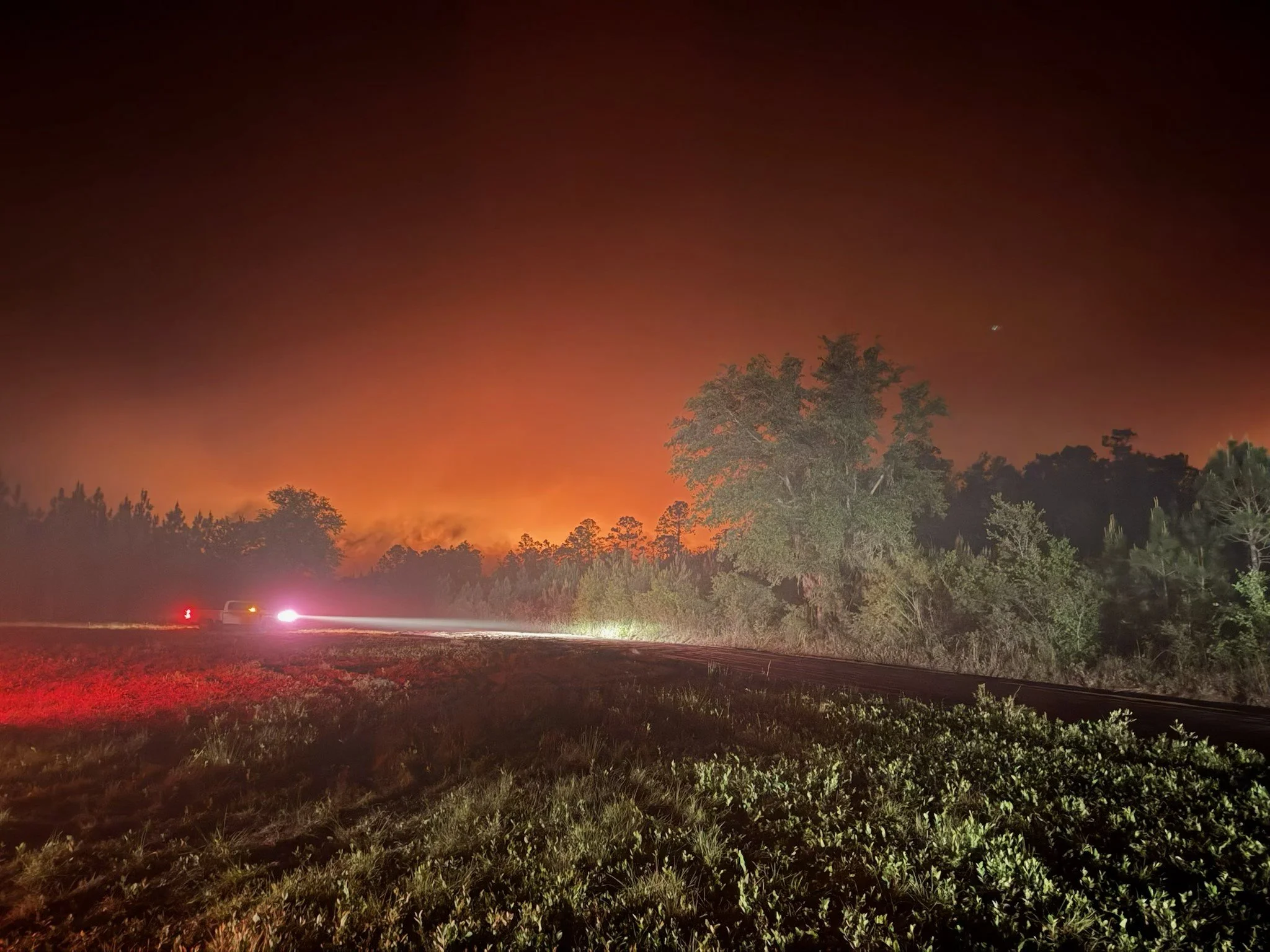
Pineland Rd Fire at night.
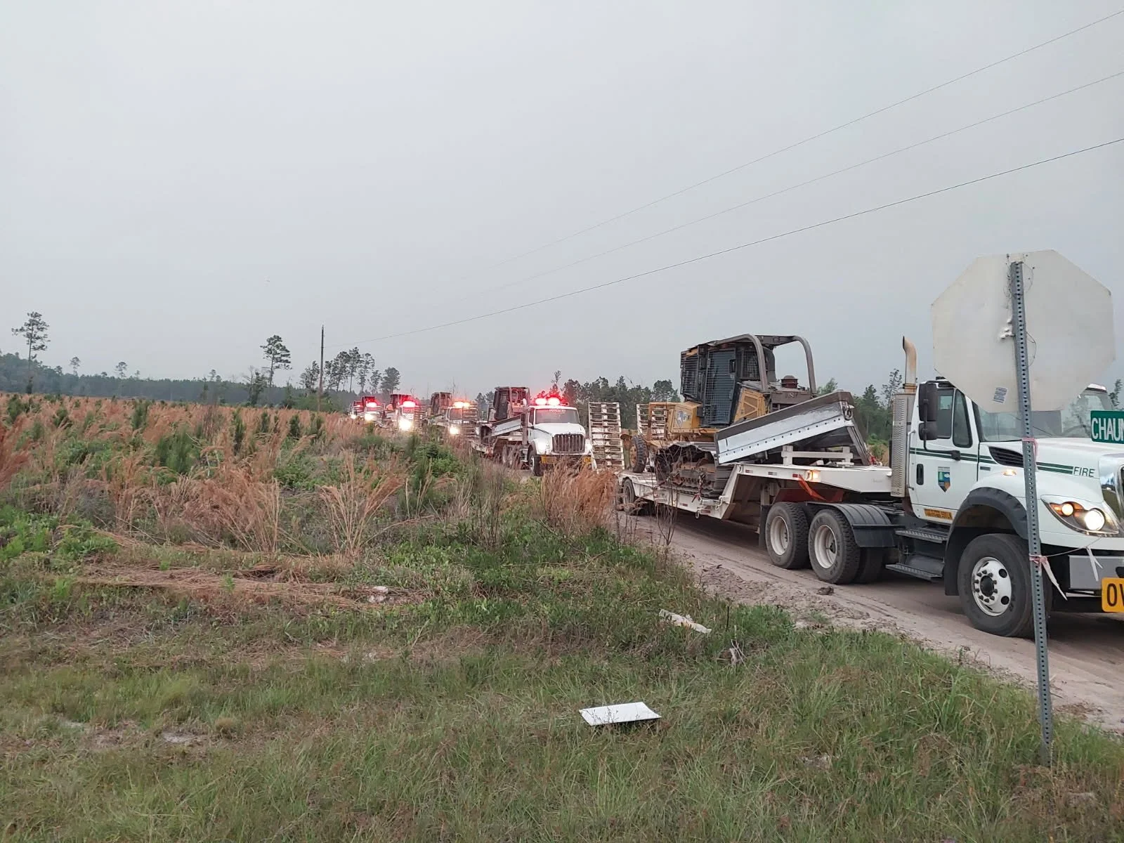
Firefighting Equipment arriving at the Pineland Rd Fire.
National Forests
There are currently no active fires in the National Forests of Northeast Georgia but when there are, many of the following frequencies will be active. Unless stated otherwise, these frequencies will most likely be P25 digital. The AM aircraft frequencies below could likely be used in south Georgia as well:
171.5750 P25 Brasstown Repeater
170.4625 P25 Glassy Mt Repeater
171.1375 P25 Long Creek Repeater
168.7750 Tac 1
166.5625 Region 8 Tac 4
168.6500 National Flight Following
167.4250 Air to Ground 13
167.7000 Air to Ground 46
168.5375 Air to Ground 54
166.9500 Air to Ground 81
122.1250 AM Air to Air
122.9250 AM Air to Air
122.9250 AM Air to Air
123.1500 AM Air to Air
123.2750 AM Air to Air
How do you talk to a spacecraft that is going to the moon or beyond?
The Deep Space Network (DSN) is NASA’s international array of giant radio antennas that supports interplanetary spacecraft missions, plus a few that orbit Earth. The DSN also provides radar and radio astronomy observations that improve our understanding of the solar system and the larger universe.
The three Deep Space Network complexes are located at Goldstone, near Barstow, California; near Madrid, Spain; and near Canberra, Australia. The strategic placement of these sites permits constant communication with spacecraft as our planet rotates – before a spacecraft sinks below the horizon at one DSN site, another site can pick up the signal and carry on communicating. You can read more about the DSN at this site.
This online tool will let you see what the DSN is up to right now. Which antennas are currently in use? Which spacecraft are talking to us? How quickly is data being received? How long does a signal take to get there, and back? Click on an antenna to see more technical information about the live link between the spacecraft and the ground.